So I read Warren’s post about scouting the race course, and I think to myself “Self, that sounds like a fine idea. Plus, today’s so FREAKIN’ BEAUTIFUL a run at Bluff Point might just set things straight in the world.” So, I head there (while I’m on my way to Waterford to do a little bit of work in the evening) with the plan of knocking out a quick lap of the point, and leave the other section, the one I haven’t ever run, as a surprise for race day.
I didn’t take a race map, which turned out to be a mistake, though in the end quite a pleasant one. You can look at one here. Just a bit of warning – this is a long post.
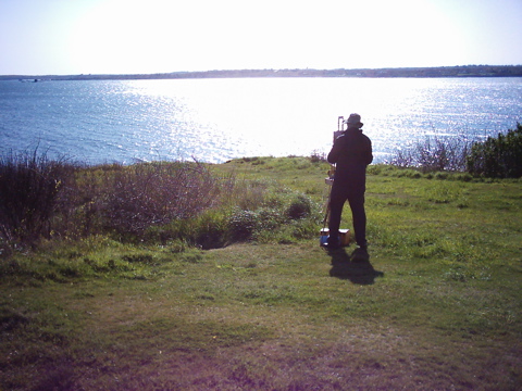
The loop on the point goes counter-clockwise. I usually run it clockwise, so this was the first stretch for me. The start of the race is going to be pretty fast – it’s flat from the parking lot until after crossing a small creek at about .75 miles. After the creek, there’s a couple of minor hills until you get out to the Sound. This was a great change for me – somehow, running this leg south rather than north seemed fraught with possibility – the wide expanse of water stretching out while I ran. Good stuff.
Once you get out to the actual point (with the bluff, natch), the course turns uphill. There’s a pretty steep section just around the first corner, then it’s downhill towards Mumford Point. As the course turns north, things get pretty steadily uphill. Not steep by any means, but certainly uphill.
This was a fun section today – As I made the turns east and then north at the point, I caught glimpses of someone riding a MTB, and not going particularly fast. Not that there’s anything wrong with taking one’s time, especially on multi-use trails, but the whole “small dog” thing kicked in, and I wondered if I could catch the cyclist on the uphill. I’ve ridden it a few times, and it’s kind of a bear pedaling while trying to avoid babies’ heads and sand and loose gravel. Anyhow, about halfway to the Foundation (old colonial Governor’s house – colonial as in the time period, not the house – there’s nothing left but the basement walls), I see said cyclist, and realize he’s about 12. I pass a couple of words of encouragement (something along the lines of “Hey, downshift and spin – you’re doing great!”) and he flashes me a toothy grin. Man, I can’t wait to get the boys out on the trails. I caught his dad about 20 yards later. You could tell he wasn’t thrilled about being caught by a runner, but he was beaming as he looked back and saw his boy chugging along.
At the foundation, I took the right down towards Mumford Cove. This is a deceptively tough section, as my tendency when running downhill is to land on my heels. Which, on this section of trail, is a sure and certain way to bring on shin-splints and possibly throw a knee. The upper section is just good old Connecticut babies’ heads and hardwood roots, but when the trail gets down along the water’s edge, it becomes either mud or straight up exposed granite. For this, and this reason only, I’d possibly suggest a straight-up road shoe, instead of trail shoes, to cushion against heel strike. Downhill on granite is tough, no matter what kind of Chi or Pose you’re smoking.
Past the granite is a flat, grassy section. Unless it’s muddy, pace will pick up here something fierce, as the rest of the course is relatively flat. After the grassy section, the course takes a right onto the road that runs parallel to AMTRAK. This is where I’d planned on turning back to the car, but I was pretty happy about then – I’d done 4 miles in 33 minutes, which isn’t shabby, considering I kept dialing back my perceived effort. So, despite not having a map, and never having run Haley Farm, I channeled a little bit of Jeff, and figured “Hey, what the heck? Why not go explore?”
The road parts aren’t bad at all – cinders and a little dirt. However, there’s about a half mile that’s run on actual railroad ballast – jagged, strawberry sized rocks. There’s a singletrack there, but I imagine I’ll be dodging runners coming the other way.
I’m completely sketchy on the map at this point – I’d never run Haley Farm, but will include it in my future plans – very nice property. Looking at the map, my best guess is that the race goes over a pedestrian bridge over the tracks, then turns right and runs parallel to the tracks on the north side for a while. I didn’t take this road today, but it looked like a really nice dirt road. Again, I think that once the race gets off of Bluff Point, it’s going to be fast and flat (with the exception of the overpass). The turnaround is at the parking lot for Haley Farm.
It looks like I ran the “back” portion of the Haley Farm loop this evening as the out portion. It’s a great stretch of road – it’ll be a long, slight uphill from the parking lot to the railroad bridge. Just after the parking lot, there is one of the finest rock walls I’ve ever seen. It’s almost nice enough to have been like a solid wall – the top corners are exceptionally square, and there’s a really nice corner where two sections of wall come together.
(*** NOT RACE PREVIEW ***) In any case, when I got to the parking lot, I figured “Hey, my guess is that the folks planning the race are going to want to kill us”, so I took the trail that looked like it’d have the most climbing. A couple of wrong turns later, I ended up on one of the fields at Fitch High School, frightening about a half-dozen wild turkeys who were coming out for an evening scratch. Wow. The school had great facilities. And a view that, quite frankly, I couldn’t believe a public high school could afford. Go Falcons!
A couple of minutes of jogging the school perimeter, and I couldn’t find a well defined trail back down. So, rather than doing what a sane person would do and going back to the place from whence I’d came, I started bushwacking downhill, figuring that I’d either hit railroad tracks or something else. Eventually, I found a trail, and took the path that looked the most westerly and the most downhill.
Of course, this was the wrong way. I kept wondering when I was going to find the railroad bridge again, so I called up the Forerunner’s handy “breadcrumb” map. And lo and behold! I was already paralleling the tracks I’d run on the out. I could have gotten back by taking the north side of the tracks all the way to the park entrance, but that would have added mileage, and I was already pushing six for the afternoon.
So I turned around, saw another deer, and headed up the hill to take the fork that I was pretty sure would take me back to the bridge. Quick note on the deer – I saw, quite literally, a ton of deer (assuming an average weight of slightly less than 200 lbs – I saw probably a dozen) this evening. The funny thing is that they didn’t run when they noticed I was headed their way. They looked at me for a while, then kind of wandered into the bush. Pretty cool. (*** End the wrong turn ***)
Finally found the railroad bridge, and absolutely flew home. The last mile and a half are flat, flat – quite possibly even slightly downhill. Finishing strong should not be an issue.
So that’s the course. The first mile and a half are pretty easy – straight out to the Sound, a couple of rollers. The next mile is a decent uphill – not steep, per say, but consistently up. Next mile – downhill, significant part on bare rock. The rest of the race should be decently flat, with the exception of the railroad bridge.
Useless Stats – today I did 8.4 in 76 minutes. Not shabby at all. Like I said, the first 4 were 33 minutes flat. The killers were mile 6 and mile 7 – those were the mile from the Haley Farm parking lot up to Fitch, and the mile where I was lost and wandering through the woods. Wildlife was a dozen or so deer, half-dozen wild turkeys, and a bunch of squirrels. Fallout of going almost 3 miles further than my previous long run for the year (6 miles as far as I can recall) in a pair of shoes I don’t usually wear is a blister on the ball of my left foot, and a blister on the heel of my right foot, just below the Achilles’ tendon. I’ve already drained the blister on the ball, the other one’s small.
Recovery beverage was 20 oz of Guida’s Strawberry reduced-fat milk. Kind of like a sports drink with protein. Went with the Guida’s over NesQuick. Why? Because, the Guida’s was 170 cal per 10 oz serving, while the NesQuick was freakin’ 200 cal. Which was kind of amazing, since the NesQuick was made with skim milk (“Fat Free!” the rabbit said), and the Guida’s was either 1 or 2%. So, I was getting a better recovery balance, and avoiding (some) processed sugar.
Today was an important run for me (Important day at the Giro – Petacchi, arguably the best sprinter in the world, finally won a stage). I haven’t gone this long since September in Norway. I’d been really concerned about the race because of that. But, I showed I could make the distance, and I finished with a little bit left in the tank. I’m totally psyched about the race. If I can manage 8:15’s without getting lost, I should be able to come in at under an hour. I’ll be happy if I can come in under 65 minutes, which’d be right around 9 minute miles.
Next project – the 8 lbs between me and 159. Which should get me to the last week in June and the start of Marathon training in earnest. (And the pipe dream of a Boston qualifying time).
